ITE Canada 2026, Part 1: Inspiring Projects
This is part 1 in a 3-post series about my experience at the 2026 Institute of Transportation Engineers Canada Conference, which happened in my home city of Victoria. Each post discusses the contents of a few presentations united around a core theme.
A new neighbourhood in Toronto
Stephen Oliver and Mavjot Kaur at GHD gave us an overview of the transportation master plan for a new brownfield neighbourhood in Toronto. The land is also known as Ookwemin Minising, meaning "place of the black cherry trees", located on the territory of the Mississaugas of the Credit First Nation. The area is located on a historic trading route for not just the Mississaugas of the Credit, but the Anishinaabeg, Chippewa, Haudenosaunee and Wendat peoples. The land acknowledgement is really important here, during this rare event where the land is being transformed, from industrial portlands into a space for people to live.
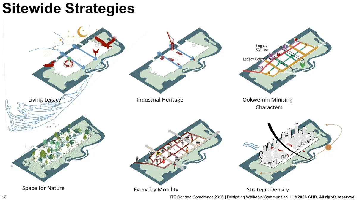
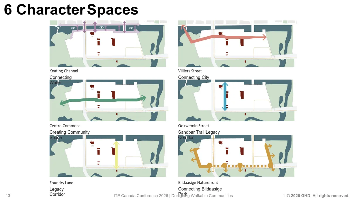
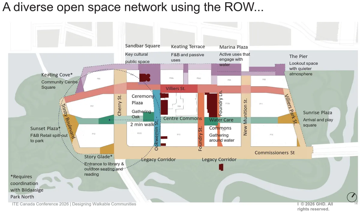
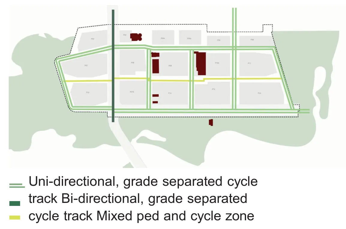
Every street in this grid has a distinct identity and purpose, and there's of course a clear street hierarchy. Nearly every street also has dedicated cycling infrastructure, even where not strictly necessary, in order to future-proof the area, and remove any possibility of future controversies or bike lane removals due to current Ontario politics.
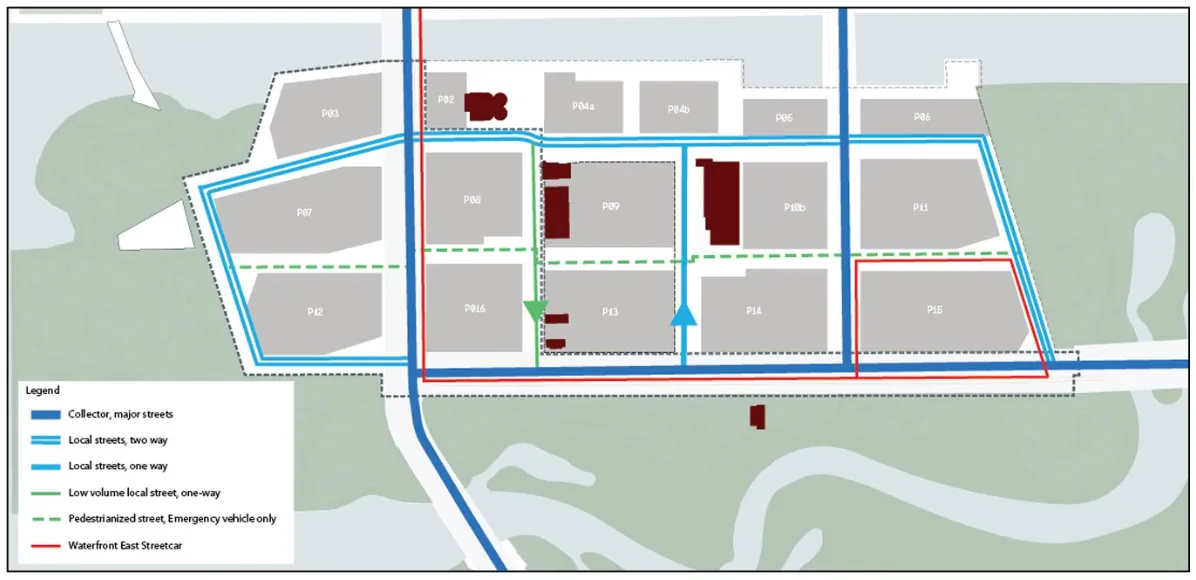
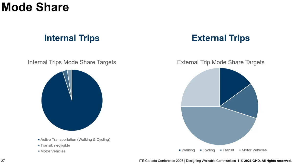
Planners also took a progressive approach to mode share: "More auto infrastructure = More auto mode share". Instead of forecasting the mode share split, they defined it based on the parameters of the project and set target goals. Forecasting for auto demand considered parking availability, rather than solely relying on trip generation manuals, which would have driven the numbers up. Parking and loading are intended to be accommodated by buildings rather than using curb space.
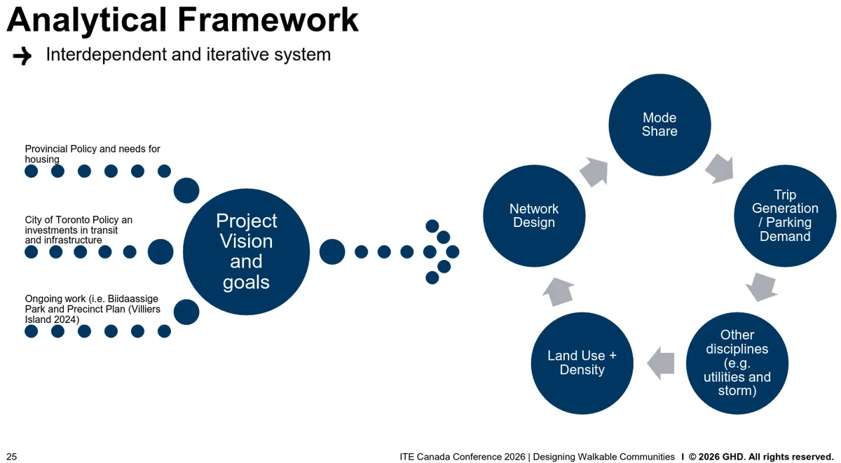
I thought this was a wonderful plan for a livable, cycling and walking-friendly public realm. Only time will tell if this comes to fruition.
Sinclair, a complete street built from the ground up
Associated Engineering walked us through the District of Saanich's Sinclair Road upgrade project, which I consider a landmark project for the Capital Region - more on the cycling design features in a moment.
The presentation focused on the geotechnical challenges with this road, including its steep grade and soil contamination. They replaced the 1960s era water main, storm and sanitary sewer, and had to remove soil 'exceeding industrial levels of contamination' from its 100 year history. To make contract administration easier, they didn't go by the cubic meter, and instead attached soil removal to the manhole digging contract.
They softened the overall grade from 16.7% over 300m, to 16%, and softened side slopes from steeper than 3:1 to 3:1. Some driveways had slopes of 19% and points where vehicles had obviously bottomed out, and the engineers worked with residents on detailing the driveways, showing the designs before construction. This allowed them to make minor adjustments and end up with residents who were happier with the project after all the disruptions it caused. For retaining walls, to keep costs down, they used lock blocks where less visible, and shotcrete pile wall where aesthetics matter.
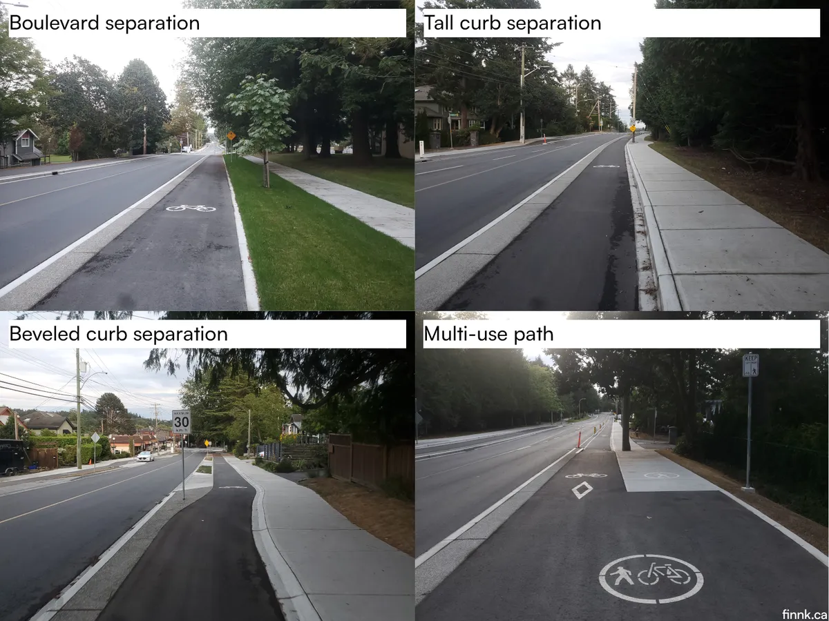
The cycling infrastructure on Sinclair is a great example of what a rebuilt street can look like, particularly the raised, separated cycle paths. The design was informed by the BC Active Transportation Design Guide and the District of Saanich's design standards (Schedule H). Though the design choices appear context-driven and feel comfortable to use, Sinclair is practically a demonstration street with an example of virtually every type of separation and intersection treatment, making it worth a visit.
Cycling spaces include:
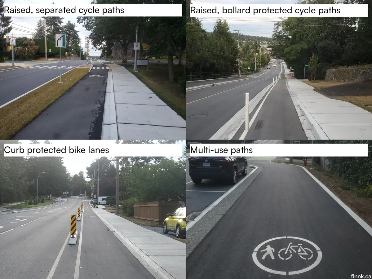
Separation between bikes and pedestrians includes:
Intersection treatments include:
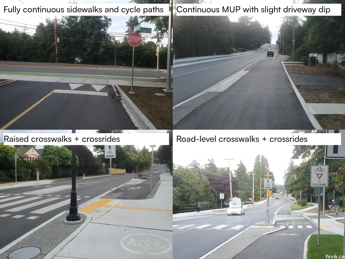
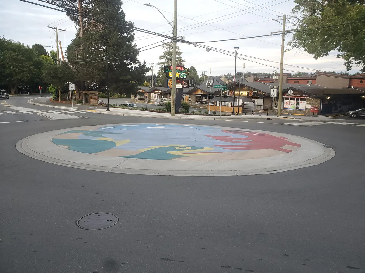
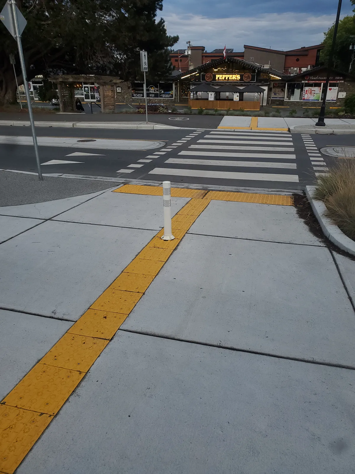
The street is a joy to cycle because the majority of its length is separated from pedestrians on wide, raised cycle paths with some amount of separation from cars. MUPs are used in the right places to provide extra space where it counts. The steep uphill section is a one-way (for bicycles) MUP which provides extra room for zig-zagging, getting off and pushing, and for faster uphill riders to pass slower ones. At the roundabouts which bookend the project, there are also MUPs. The intersection of Sinclair Road and Cadboro Bay Road was converted from a four way stop into a roundabout to improve traffic flow, and while I generally don't like urban roundabouts for walking and cycling, since it was compact and low speed (unlike typical Canadian roundabouts emulating the MUTCD design) it didn't feel uncomfortable to cross.
This was definitely a very expensive project and the variety of designs used didn't help this. A typical street rebuild will probably stick to one design - but Sinclair makes the case that raised cycle paths and continuous intersections should be part of that design.
Improved traffic signals at MoTT intersections
Trevor Demerse, senior traffic operations engineer with BC's Ministry of Transportation and Transit (MoTT), showed us some signaling improvements, particularly for pedestrians, that he championed. He covered the changes made by advocating to expand the scope of projects, and the importance of being a champion for positive change within institutions like MoTT.
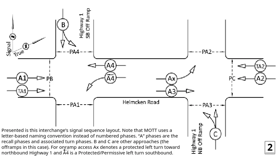
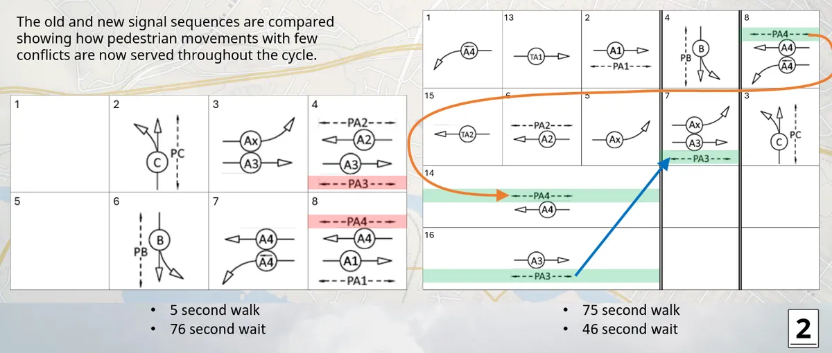
Project 1: Helmcken interchange on Hwy 1. Until recently, some pedestrian signals (PA3 and PA4 below) here wouldn't serve a walk signal during a phase where there was no conflict. Trevor noted that to the public, this looks like "why isn't it white, are they stupid?" In reality, this behaviour was due to limitations in the traffic controller.
For those of you who can read ring-barrier diagrams, the following images show the changes to the signal phasing.
Project 2: Tillicum Road at Hwy 1. This intersection has the longest straight cycle in the province: 120s of uninterrupted green for the highway, and a 210s overall cycle length. Trevor advocated to expand the scope of the Tillicum Active Transportation Bridge Project to include traffic signal changes. This is a lot of additional work, but will result in a safer and more efficient intersection.
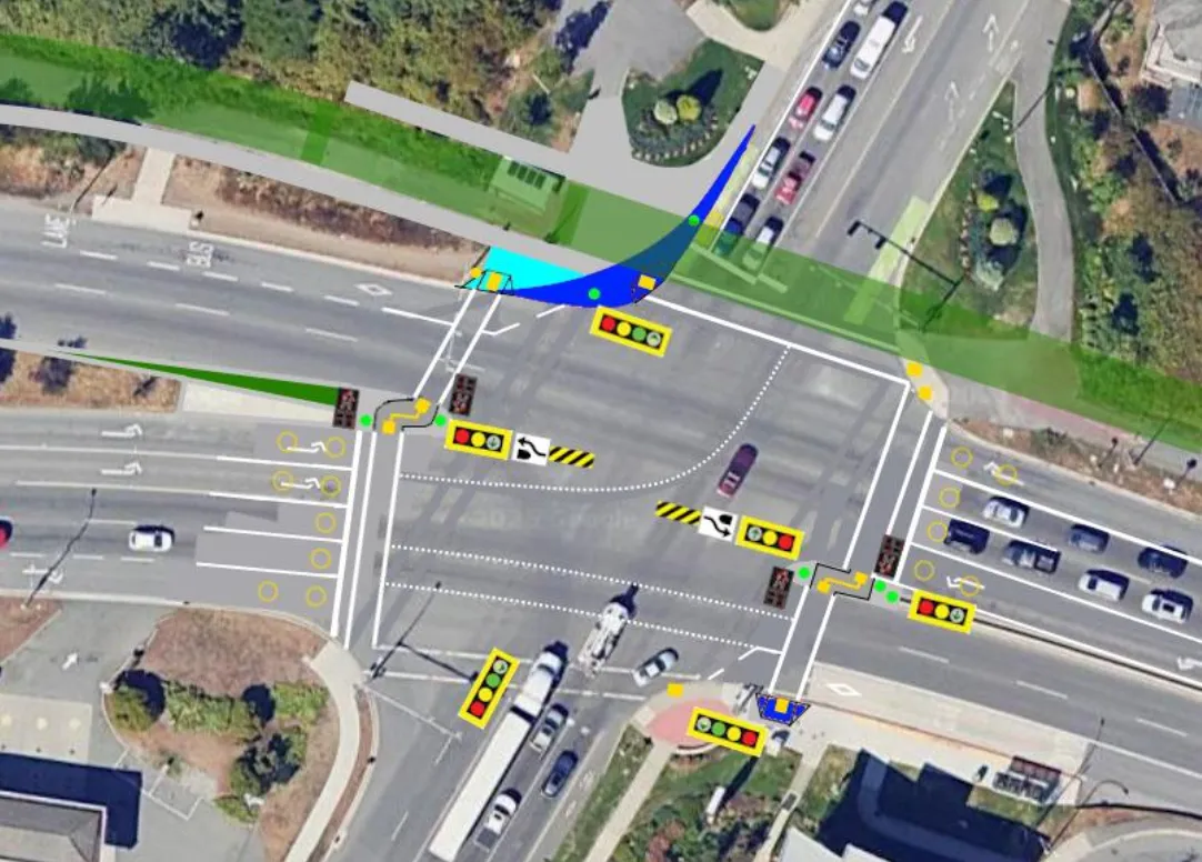
The design is complicated, with 10 vehicle phases, 10 pedestrian phases, and independent pushbutton detector channels, per-direction, per-crosswalk. It's built on knowledge gained from other MoTT two-stage crosswalks, like Jingle Pot / Mostar at Hwy 19 in Nanaimo, which uses walk signals in one direction, something I didn't expect to see in North America. The diagram below, which doesn't show all signal heads, hints at there being right turn overlaps, which could be paired with no right turn on red.
It can't be understated that these are very positive changes for MoTT, an organization with a reputation for overbuilt dimensions and pedestrian-unfriendly designs. Trevor notes that institutional change is easier in steps, and emphasized the importance of capturing what's learned in standards, policies and procedures over time.
That's it for part 1 of my ITE Canada 2026 recap! Stick around for parts 2 and 3, The many meanings of Accessibility, and Bus and Rail Transit!